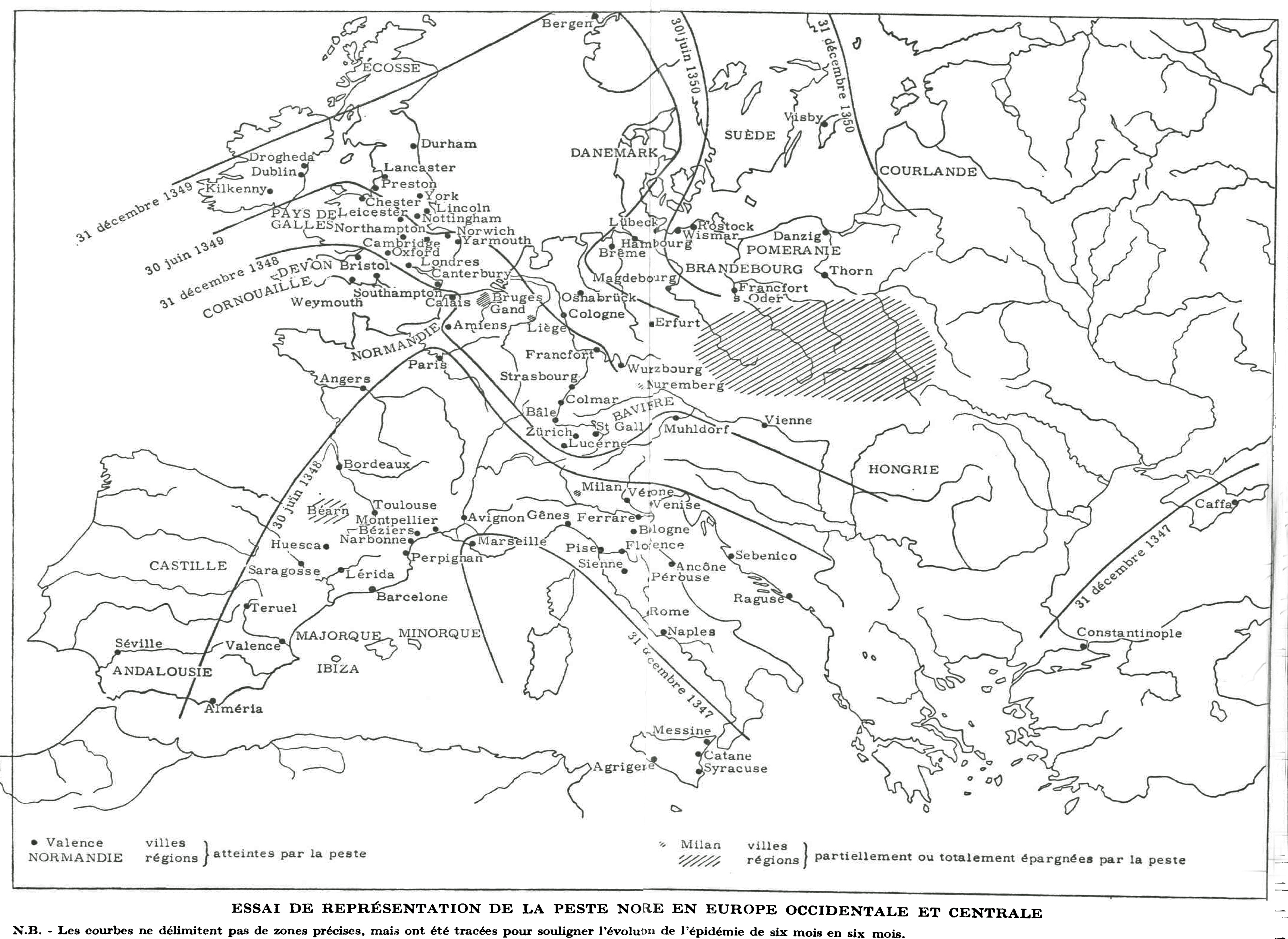
Carpentier Elisabeth. Autour de la peste noire : famines et épidémies dans l'histoire du XIVe siècle. In: Annales. Economies,
sociétés, civilisations. 17ᵉ année, N. 6, 1962. pp. 1062-1092;
doi : https://doi.org/10.3406/ahess.1962.420916
https://www.persee.fr/doc/ahess_0395-2649_1962_num_17_6_420916
"Mapes, plànols i croquis a la documentació històrica de les terres de Lleida, segles XVII-XX"
Territori i societat, IX, pp. 235-272.
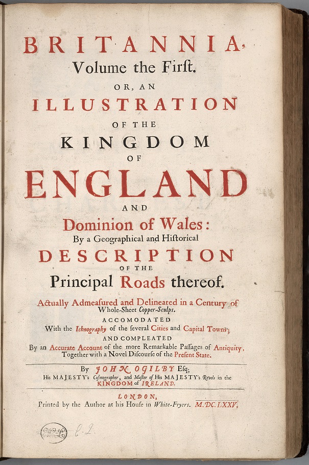
Britannia…, volum 1, A Geographical and Historical Description of the Principal Roads thereof.
Londres: Taller de l’autor.
Mapes
David Rumsey Map Collection
"Here you will find one of the greatest historical atlases: Charles O. Paullin and John K. Wright's Atlas of the Historical Geography of the United States, first published in 1932. This digital edition reproduces all of the atlas's nearly 700 maps. Many of these beautiful maps are enhanced here in ways impossible in print, animated to show change over time or made clickable to view the underlying data—remarkable maps produced eight decades ago with the functionality of the twenty-first century"...
Digital Scholarship Lab, University of Richmond
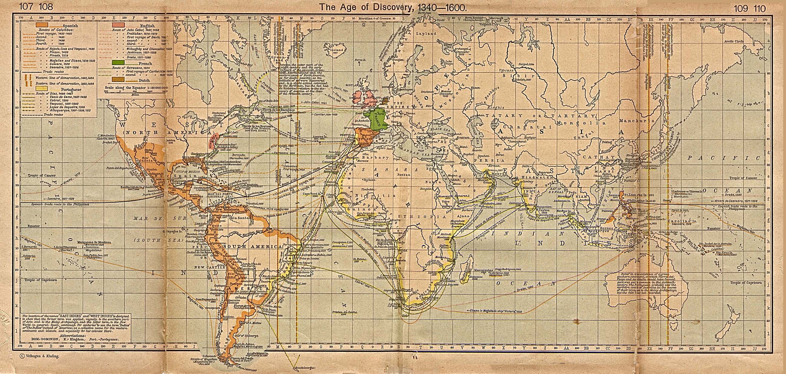
The Age of Discovery 1340-1600
The Spread of Colonization, 1600-1700
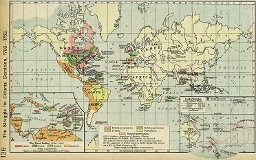
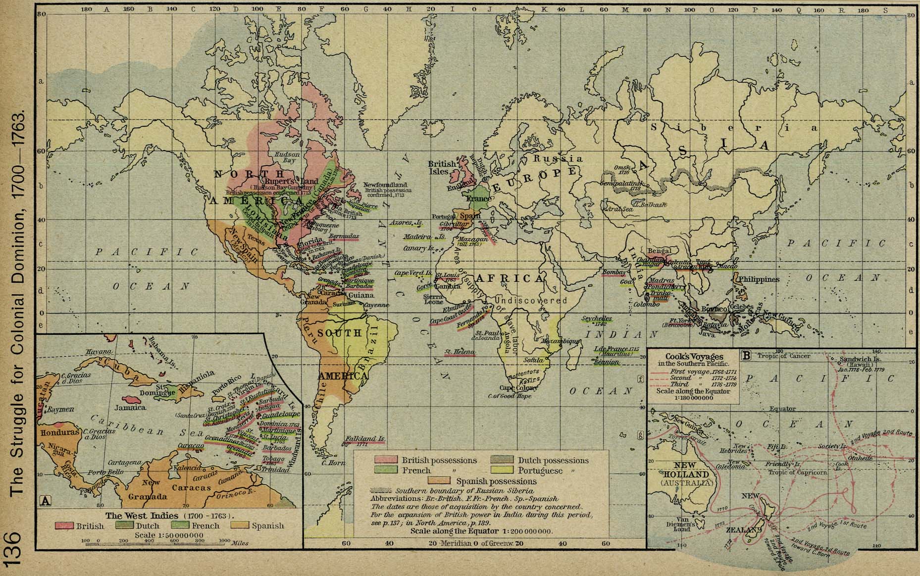
The Strugle for Colonials Dominion, 1700-1763
Americanized Encyclopaedia Britannica
Àfrica 1890
Gardiner, Samuel Rawson
David Rumsey Map Collection
Mapa síntesi, ampliable
(Fons FECSA)
Institut Cartogràfic de Catalunya-Cartoteca Digital
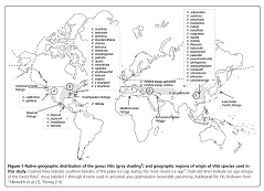
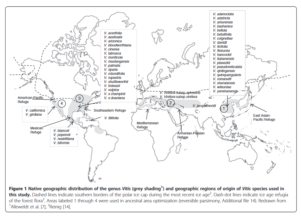
Wan, Yizhen & Schwaninger, Heidi & Baldo, Angela & Labate, Joanne & Zhong, Gan-Yuan & Simon, Charles. (2013). A Phylogenetic Analysis of the Grape Genus (Vitis L.) Reveals Broad Reticulation and Concurrent Diversification during Neogene and Quaternary Climate Change. BMC evolutionary biology. 13. 141. 10.1186/1471-2148-13-141.
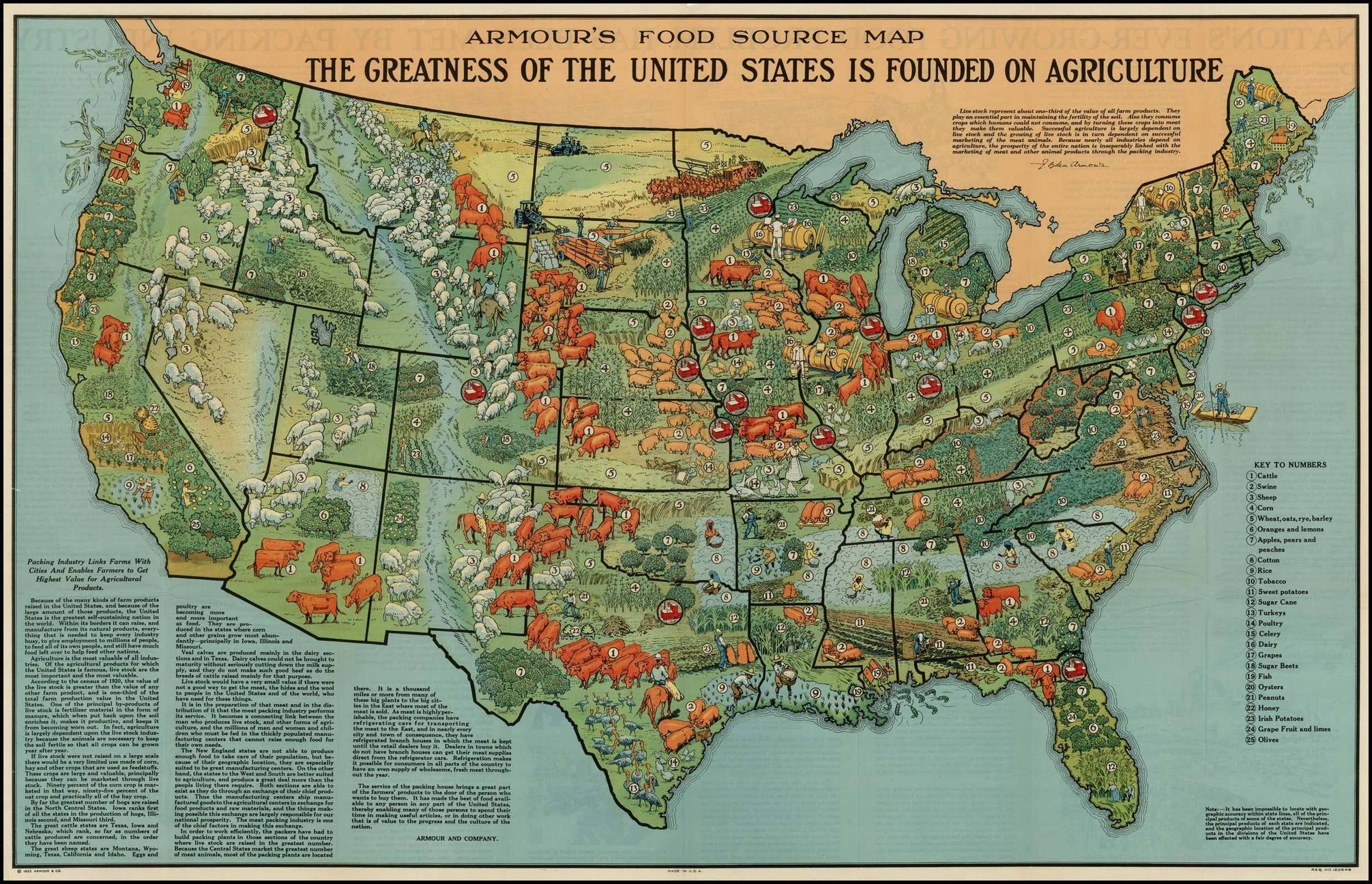
40 maps that explain
food in America
by Ezra Klein and Susannah Locke
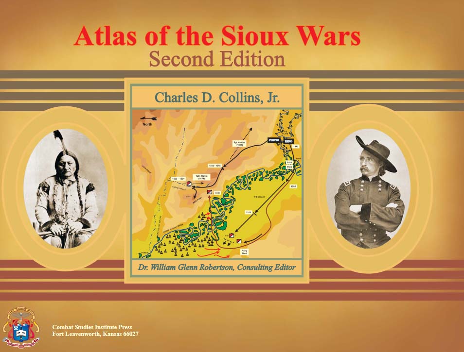
Atlas of the Sioux Wars
by Charles D. Collins, Jr.
Combat Studies Institute Press, 2006
Molts mapes per a difereents cultius.
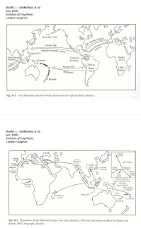
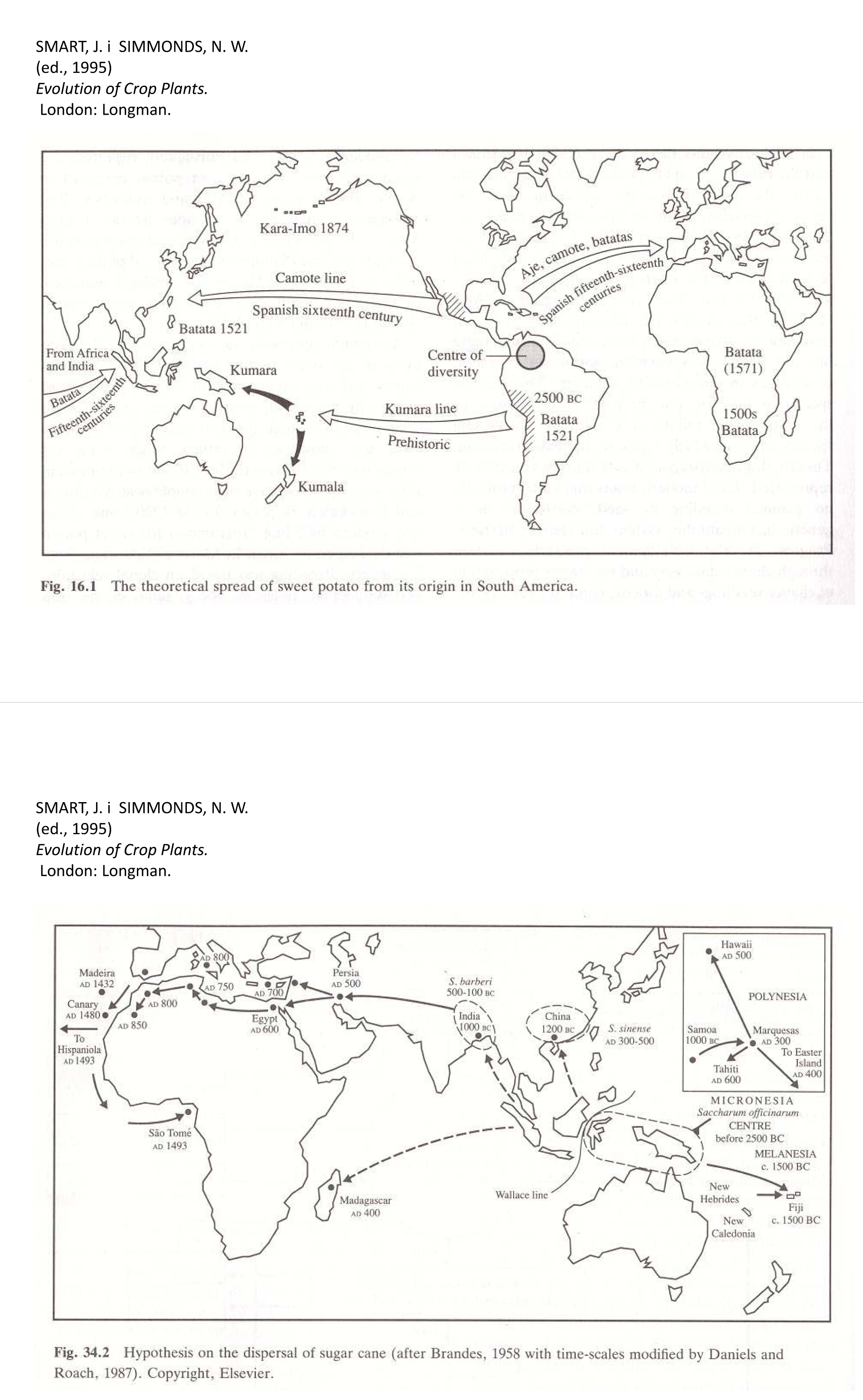
SMART, J. i SIMMONDS, N. W. (ed., 1995)
Evolution of Crop Plants.
London: Longman.
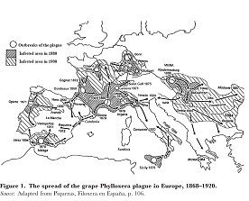
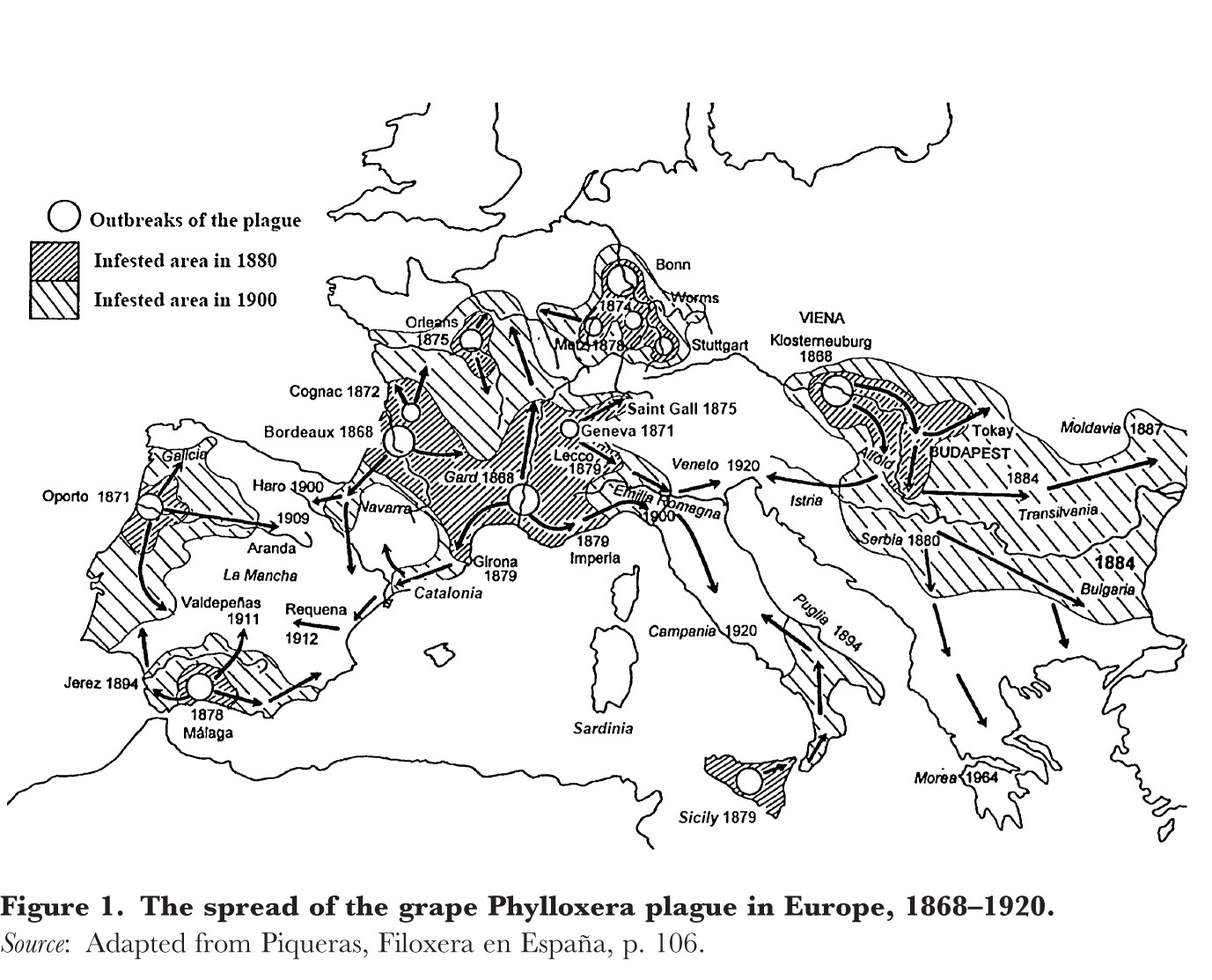
Expansió de la fil·loxera a Europa.
Vicedo-Rius,
Enric (en premsa)
"La vinya i la fil·loxera a la zona mediterrània
catalana. Les terres de Lleida: oportunitats inicials i
crisi final (1868-1910)".
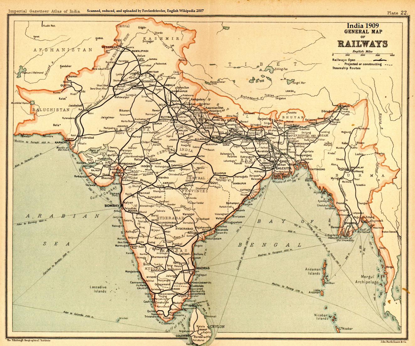
A general map of Indian railways, 1909. Scanned and reduced from personal copy of Imperial Gazetteer of India, volume 25 (Atlas), Oxford University Press, 1909, by Fowler&fowler«Talk» 05:05, 18 September 2007 (UTC)
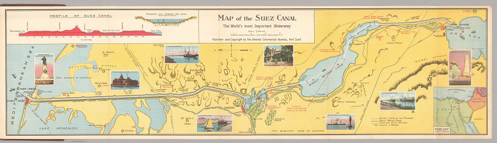
Map of the Suez Canal.
The World's most Important Waterway,
Autor:Rosenberg, August.
Oriental Commercial Bureau, Port Said